US Census: More than half of Puerto Rico residents face high disaster risk
New data tool shows vulnerability by town to recovering quickly from natural hazards.
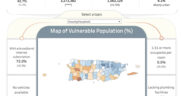
More than half of Puerto Rico’s residents live in areas classified as having “high” social vulnerability to natural disasters, according to the U.S. Census Bureau’s 2023 Community Resilience Estimates (CRE) for the island.
The data, released this month, is designed to ayuda planners, public officials and community organizations identify and address local disaster risks. It marks the first time the Census Bureau has produced estimates for the island using the same methodology as is used stateside.
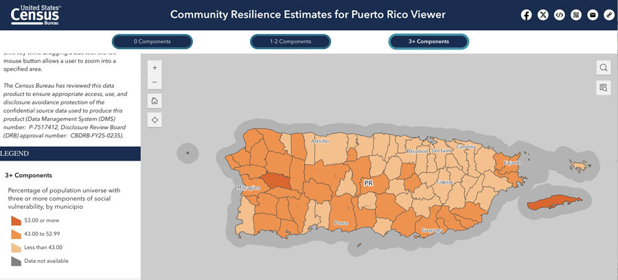
The updated CRE maps every census tract in Puerto Rico into one of three categories — low, medium or high vulnerability — based on 10 social indicators from the Puerto Rico Community Survey.
These indicators include poverty, caregiver presence, household crowding, education, employment, disability, insurance coverage, age, vehicle access and broadband internet.
“These updated estimates provide Puerto Rico-specific insights using the same methodology and indicators applied to the 50 states earlier this year,” the Census Bureau stated. “The tool enables users to explore social vulnerability by area and to view local hazard risks from the Federal Emergency Management Agency’s National Risk Index.”
The National Risk Index calculates expected annual economic losses from hazards such as hurricanes, earthquakes, landslides and floods. When combined with the CRE, users can see which places face both high exposure and reduced capacity to recover.
The estimates are available through the Census Bureau’s data portal, API and mapping tool, offering analysis down to the census tract level.
For example, towns like Loíza, Maricao and Adjuntas show high vulnerability across most of their tracts. In contrast, areas such as Guaynabo, Bayamón and Gurabo show moderate to low vulnerability in many neighborhoods.
According to the Census Bureau, “Local planners, public health officials and decision-makers can use these estimates to develop targeted mitigation and recovery strategies.”
The 2023 release also highlights challenges in transportation, internet access and health coverage, helping officials identify groups that may face prolonged recovery periods after a disaster.
This is the first CRE update for Puerto Rico and part of a broader federal push to deliver localized data for disaster preparedness and equitable recovery planning.