
El USGS invierte $1.1M en cartografía geológica e investigación sobre deslizamientos de tierra en Puerto Rico.
The U.S. Geological Survey (USGS) recently invested $1.1 million in a geologic mapping project throughout Puerto Rico using airborne hyperspectral imaging to chart surface geologies essential to natural hazards resilience.
The project, funded through the 2023 Disaster Relief Supplemental Appropriations Act, employs aerial surveys to map the geologic landscape. The aim is to better understand natural hazards and identify materials for constructing hazard-resilient infrastructure.
Research was conducted through lower-altitude (approximately 11,000 feet) flights that collected data from reflected sunlight at a fine resolution over three regions: western Puerto Rico near Mayagüez, southern Puerto Rico near Ponce, and the central mountains near Jayuya.
The aircraft’s sensors recorded both reflected solar radiation from the visible to near-infrared and shortwave infrared wavelengths, as well as thermal emissions at longer infrared wavelengths. These sensors are termed hyperspectral because they cover the electromagnetic spectrum, allowing researchers to distinguish among various materials such as different rock, soil and vegetation types due to their unique reflectance characteristics, or “spectral signatures.”
“Looking for these patterns, or spectral signatures, can help identify locations with high potential for mineral resources and allow us to map landslide source areas and study vegetation recovery in these areas,” said Bernard Hubbard, a USGS research geologist with the Geology, Energy and Minerals (GEM) Science Center in Reston, Virginia.
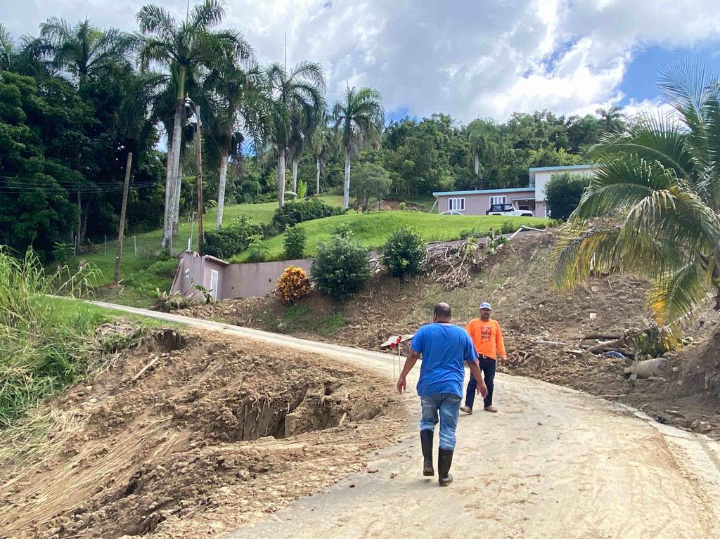
Areas of particular interest for the surveys included regions affected by landslides following hurricanes Maria and Fiona; the island’s exposed limestone quarries; cement-producing plants for industrial minerals and materials such as quartz sand and gravel; and critical minerals necessary for post-hurricane reconstruction and storm resiliency.
The USGS also collaborated with the University of Puerto Rico (UPR). At the UPR’s Río Piedras campus, Carla Restrepo, a biology professor at the university’s College of Natural Sciences, will use the data to examine how organisms influence landslide formation.
“Specifically, the hyperspectral data may help identify vegetation covers that better protect slopes from failure,” said Restrepo. “These data may aid characterizing conditions that favor microbial weathering, that is the process by which microorganisms contribute to the decomposition of rocks.”
