
$10M drone grid to boost emergency response, farming, and connectivity
Puerto Rico is about to become the first U.S. state or territory to have a comprehensive drone infrastructure used for services in agriculture, emergency response, environmental monitoring, public safety and smart city planning.
The $10 million, islandwide project will begin its initial phase by the end of the year, or in the first quarter of 2026 at the latest, Juan Padilla, founder of CSO Technology Partners, told News is my Business.
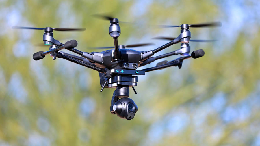
The project, known as Grid of Autonomous Vehicles – Yielding a Mesh (GAVYM), will consist of a network of 200 autonomous drones and 100 command stations and employ about 30 people, most of them drone pilots and data workers. It will also include 50 specialized drones for precision agriculture. CSO is creating the grid and developing the software and applications in collaboration with Caribe Drones in Ponce.
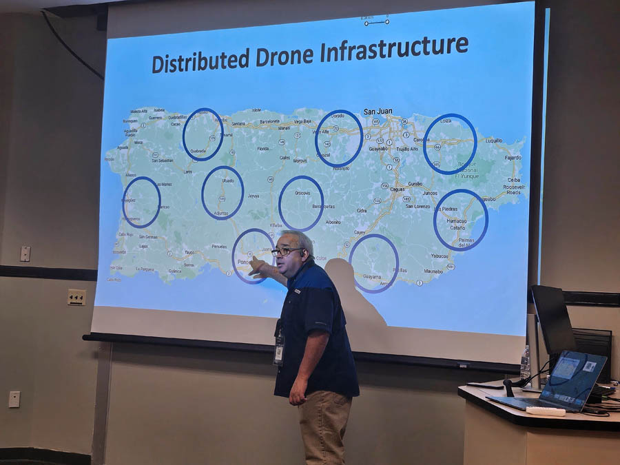
GAVYM will be deployed in five phases or regions: San Juan, Mayagüez, Arecibo, Ponce and Gurabo. The company established these regional hubs via alliances with the Puerto Rico Science, Technology & Research Trust (PRSTRT) in San Juan, University of Puerto Rico in Mayagüez, Inter American University in Arecibo, UPR in Ponce, and Ana G. Méndez University in Gurabo. CSO is presently running a pilot docking station from its main hub in PRSTRT-San Juan.
Multiple docking stations will facilitate the use of drones throughout Puerto Rico, Padilla explained.
“The idea is to be able to arrive at any location on the island within 10 minutes. If, for example, someone gets lost in El Yunque or there’s an accident somewhere in Jayuya, our drones can be there in less than 10 minutes and help first responders assess the situation and determine what they need to do there — if it’s enough to alert the police or if ambulances or firetrucks need to be sent to the site — making better use of resources.”
The project will also create a database of images that the universities can use for research and development.
GAVYM is being developed under the Puerto Rico government’s Economic Development Investment Portfolio for Growth, Lifeline Mitigation Program (IPG-MIT), which is supported by Community Development Block Grant Disaster Recovery (CDBG-DR) funds from the Department of Housing and Urban Development (HUD). These funds are earmarked to help cities, counties and states recover from presidentially declared disasters.
The IPG-MIT focuses on risk mitigation and the strengthening of identified lifelines — such as communications, transportation, energy, waste management and health care — to help Puerto Rico respond and recover quickly from hurricanes, floods, earthquakes and other emergencies and natural disasters. GAVYM was approved for the food, water and shelter lifeline.
CSO is also working with the PRSTRT to increase its portion of grants under the America’s Seed Fund, which awards non-dilutive funding through the Small Business Innovation Research (SBIR) and Small Business Technology Transfer (STTR) programs.
“Out of $4 billion in annual grants, Puerto Rico, based on its population, should get about $40 million, yet it only receives $1 million. We need to bring more to the island,” he said.
Drones to the rescue
The drone grid is expected to benefit Puerto Rico in the following ways:
- Increased agricultural productivity and cost savings, with potential annual benefits of 10% to 25% per farm through precision drone technology. Specialized drones can be used to spread seed and fertilizer in precise locations, reducing costs associated with waste and manual labor.
- Stronger agriculture sector and reduced dependency on imports. According to industry and U.S. Department of Agriculture statistics, Puerto Rico now imports 85% of the food it consumes.
- Faster emergency response and disaster management, particularly during hurricanes, floods, earthquakes and landslides.
- Data-driven decision-making for the public and private sectors, including traffic management, infrastructure inspections and illegal dumping detection. “It’s too expensive for agencies or companies to set this up themselves, so we develop it and make it available to anyone who needs it,” Padilla said, calling the system “drones as a service.”
- Job creation in tech sectors, especially in low- and moderate-income communities, through workforce development in drone operations, artificial intelligence and geospatial analytics.
- A model for future smart infrastructure in the U.S. and Latin America, positioning Puerto Rico as a leader in drone-based innovation.
“If something good can come out of this project, it’s that Puerto Rico will be able to improve its agriculture and emergency handling,” Padilla said.
Location obstacles spark the idea
Padilla’s idea for an islandwide drone infrastructure stems from his experiences living in an area in Corozal where individual residence addresses do not exist, which greatly limits the services residents can receive.
“About 600,000 residences in Puerto Rico don’t have official addresses and have problems with mail delivery, 911 emergencies, utilities, etc. Even FEMA [Federal Emergency Management Agency] doesn’t know who to serve there because it can’t determine where the residences are,” Padilla explained.
In the U.S., 20% of the population is classified as rural, and this percentage is greater in Puerto Rico, he noted. Based on U.S. Census figures, CSOestimates that 40% of residences in Puerto Rico lack a civic address.
Civic addresses are particularly critical for 911 and other emergency services, as they ensure that responders can quickly locate and reach the correct address in case of an incident. These addresses, which do not always correspond to postal addresses, generally follow a standard format and are used for utility connections, municipal permitting, and various government programs and services.
“No one in my family en el campo calls 911. We know that no one will arrive. There’s no way they can find the place,” Padilla said. “For me, it would be a dream to be able to deliver things and services in my neighborhood in Corozal.”
Padilla, who has a computer engineering degree from UPR Mayagüez, and three partners founded CSO Technology Partners 28 years ago after working with companies that specialized in large databases, such as Oracle. In recent years, CSO has been more involved in federal projects that involve geolocation.
“Geolocation is much more compatible with new technologies that need precision to work, such as navigation apps and self-driving cars. So I think that physical addresses will eventually cease to exist,” he said.
Among the most popular uses for drone technology throughout the world are risk mitigation, emergency response and disaster management, delivery of medical supplies, surveillance and crime scene investigation, border control, message delivery during communication breakdowns, e-commerce, logistics, and cell tower inspections, signal strength tests and network planning in telecom.
Editor’s note: See related opinion piece published in today’s Biz Views section.
