Practical Techie: Be your own meteorologist with help from the web
Caribbean hurricane weather is upon us again with the new storm season that begins today.
Meteorologists and forecasters in the local news channels keep us duly informed about the wuthering storms, but it’s prudent to know where to look on the Internet for data on other angles of the weather.
This may include marine climate in Puerto Rico, which, after all, is an oceanic island in a tropical corner of the Atlantic.
On the web, there are the classic platforms for climate information, as rain and wind or cyclonic disturbances, hit us mercilessly every year along the Antilles arc.
However, there are alternate Internet sites that we can place on our cell phones to get the full lowdown of what’s happening, when and where, during each turn of bad weather, according to our travel or individual needs.
Let’s go first with the generic ones. The National Hurricane Center page is essential. We find it at the NOAA official site.
Here we find periodic warnings about the situation in the Atlantic, warning messages, informative videos and advice from climate experts.
Another very necessary one is Tracker. It is an interactive storm locator, with constantly updated, real time information on all types of local weather phenomena.
This site also contains impressive satellite maps of our entire hemisphere. It offers radar perspectives, rain and wind activity, hour by hour. Info necessary for sailors, pilots, travelers.
And as in the news, the portal offers the so-called spaghetti models that mark probable hurricane directions.
To get specific data about rain activity, try Rainviewer.
Another necessary website is the commercial Weather Channel, which, in turn, has the greatest accessibility for users.
All of the above are free. Let’s now see apps to install on mobile phones, useful not only to keep abreast of the coming storms, but for when you are going to travel overseas, or a simple walk to the beach. Most are also free or inexpensive.
A very informative and professional one is AccuWeather. If you need detailed climate data, this app is the best. It is constantly updated with precise info on tides and marine currents, wind direction and intensity, the path of rain gusts, haze, dust in the air, sunset and sunrise, and the volume of precipitation. It offers interactive maps, videos, graphs, tables and simulations.
An app with spectacular but scientific designs is Dark Sky. It costs $3.99 and provides hyperlocal, minute-by-minute information on the prevailing weather. All scientific data is well organized and simple to understand. For that price, up to six people in the family can access it.
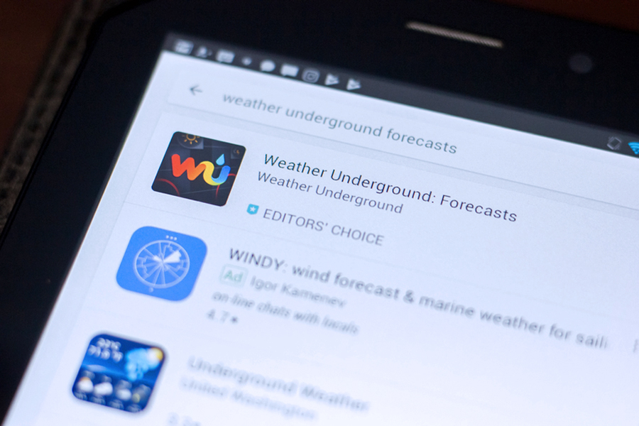
If you want an adventurous climate info site, try Weather Underground. It is super local with information on the weather from a street, town or country setting. It uses a network of 270,000 weather stations around the globe, many of them owned by people whose hobby is observing and taking note of the weather. Many of the stations are at airports, making it useful for travelers and campers.
It allows a user to be part of the forecasting experience by feeding the web with your own information. It’s free with ads. If you pay $1.99, you remove them.
Another interesting one is WeatherBug. It provides forecasts up to ten days in advance. All weather data can be viewed through 18 different maps, including Doppler radar. It allows you to enter some GPS coordinates to know the climate of the place. The service warns about thunderstorms, temperatures, alerts about any bad weather approaching your neighborhood.
It also advises about air quality for allergy sufferers and about ultraviolet density for beachgoers. And, it covers 2.6 million locations on the planet, describing how vehicular traffic is affected under different weather conditions.
If flooding is what you need to know, use RainAware. It is not limited to the percentage of rainfall, but also amount, volume, duration and location of the downpours. Also, the time of the arrival of the rains 180 minutes in advance.
Another app, somewhat expensive for $9.99 is Radarscope. However, the details on the radar maps are wonderful. It is for the true weather aficionado.
It is used by many commercial pilots to help navigate bad weather challenges.
The app includes data fromNEXRAD, a network of radar stations in the United States, Guam, Puerto Rico, South Korea, and Japan. The site also sends users alerts about tornadoes, storms and waterspouts.
There are hundreds more like Windy, Yahoo Weather and Weather App. But, at least, the previous ones are very effective in being able to deal with the unpredictable phenomena of Mother Nature.